Connecting people to places using library data – Tim Sherratt
by Dilan Gunawardana, State Library of Victoria LAB
Some results of my time as Creative Technologist-in-Residence at the SLV Lab
by Dilan Gunawardana, State Library of Victoria LAB
exploring the Library's place-based collections
Slides and notes from my talk on the results of my residency.
State Library of Victoria, Technologist Talk, 3 December 2025.
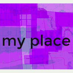
For the next few months I get to play around with metadata and images, think about online access, experiment with different technologies, and build things to help people to explore the State Library’s collections. In other words, I get to be in my happy place!
I like urls. They take you places. And if you know how to read them, they can tell you things about the systems that created them. One of the first things I did when I started my residency at SLV LAB, was to try and understand how their collection urls work. There’s a couple of well-worn methods I use when digging into a new site. The first is url hacking – this involves fiddling around with the parameters in a url and submitting the result to see what happens.
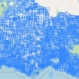
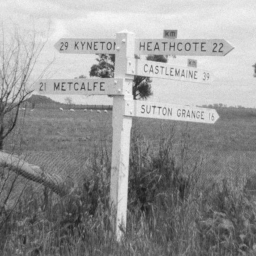
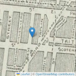
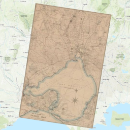
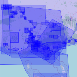
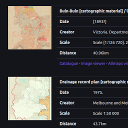
The State Library of Victoria holds a collection of 8,804 parish maps. As part of my residency at the SLV LAB, I’ve been poking around in the metadata. We could create bounding boxes by using something like AllMaps or MapWarper to georeference each individual map, but that’s going to take a while! As a quick and dirty alternative, I wondered if it was possible to generate approximate bounding boxes from the available metadata. It seems we can!
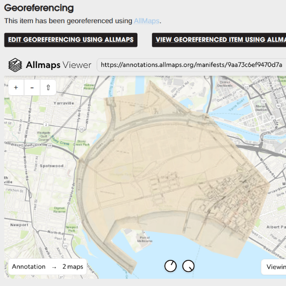
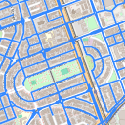
I’ve just created a workflow that uses AllMaps and IIIF to georeference the SLV’s digitised maps. There’s some technical details below, but the idea is pretty simple. A userscript links the SLV image viewer to Allmaps – so you just click on a button, and the digitised map opens, ready for georeferencing.
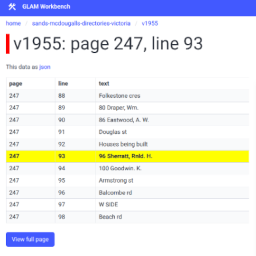
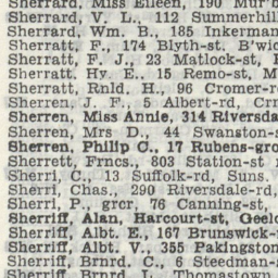
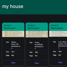
The Sands & McDougall’s directories are a goldmine for anyone researching family, local, or social history. They list thousands of names and addresses, enabling you to find individuals, and explore changing land use over time. However, there’s currently no way of searching across all 24 volumes, so as part of my residency at the SLV LAB, I thought I’d make one!
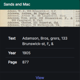
I wanted to incorporate Sands & Mac search results into a new interface. Getting the data was easy because Datasette has a JSON API baked in. But what about the images? I could just display a thumbnail of the whole page, but it would be better to show a snippet of the actual entry. Thanks to IIIF and ALTO, I now can.
My stint as Creative Technologist-in-Residence at the State Library of Victoria LAB comes to an end in a few weeks time and I’m frantically trying to pull things together.

This was the introduction to my talk on the results of my time as Creative Technologist-in-Residence at the State Library of Victoria. My slides, with my full notes are available online, but after a very strange year that has travelled from disappointment to exhilaration, I thought it was worth posting these words separately.
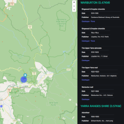
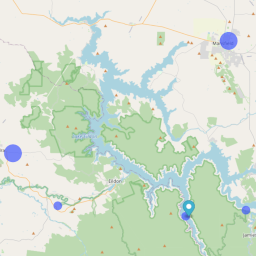
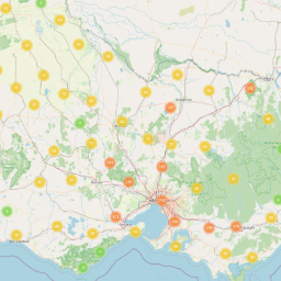
Newspapers are a vital source for local history. During my residency I pulled together some metadata relating to Victorian newspapers and put it on a map for easy exploration. Here's how.
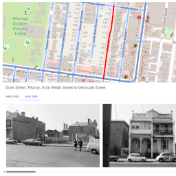
The Committee for Urban Action collection includes thousands of photos of streetscapes from the 1970s. During my residency I tried to geolocate the photos and put them on a map for easy exploration.
‘What can I find out about my house?' My work as Creative Technologist-in-Residence at the SLV LAB was inspired by questions like this that librarians at the SLV hear every day. I wanted to explore how the Library’s place-based collections could be used to provide new entry points for discovery and navigation – entry points based not on words, but locations.
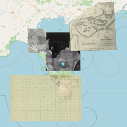
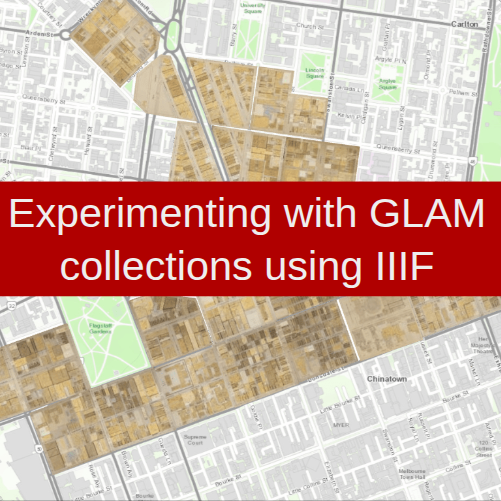
I’m in the process of tying up all the documentation relating to my time as Creative Technologist-in-Residence at the State Library of Victoria LAB. But as I was looking through the list of outputs, I realised I’d never written anything about the interface I created to explore georeferenced maps from the SLV collection.
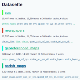
Datasette instance containing data with spatial coordinates from parish maps, CUA, newspapers, and georeferenced maps.
Github repository containing notebooks and datasets relating to the processing of collection data. (Much more to come!)
Github repository containing code for the apps and sites created duing my residency.
Github repository that automatically saves data from georeferencing every two hours, updates the summary datasets, and generates the project dashboard.
Userscript that integrates Allmaps and the SLV image viewer. See the georeferencing documentation for details.
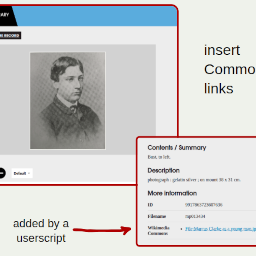
There are more than 490 digitised images from the State Library of Victoria that have been uploaded to Wikimedia Commons. This userscript searches for the handle url of a digitised image in Wikimedia Commons. If it's found, links to the Commons pages are listed in the 'Further details' section of the SLV digitised image viewer.
This userscript displays the IIIF manifest url in the State Library of Victoria's image viewer. It also includes a button to copy the manifest url to the clipboard.
Demonstration userscript that adds a 'My favourites' menu to the SLV main navigation
Demonstration userscript that lets you create a simple treasure hunt. Each page embeds some clues that point to the next digitised item. If there's an easter egg, click on it to view the clues!
A simple proxy to fix a few issues with SLV IIIF manifests. See the georeferencing documentation for details.